Learn a complex data model
In this module, the learner is introduced to one of several components of a complex GIS data model. This foundational knowledge is a critical scaffold towards the learner's ability to troubleshoot this data model with customers.
Learning objective: Given a scenario, choose whether using an event feature class is appropriate.
Excerpt from a larger module on a complex GIS data model. Originally created with proprietary software.
-
Develop learning objectives in collaboration with SMEs
Copywriting and editing
Graphic design
Assessment creation
-
MS Powerpoint
Internal proprietary eLearning software
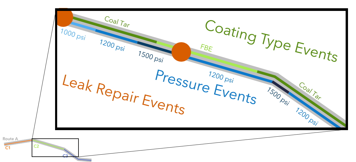
Events are locations along a network that provide additional information to the user about conditions, materials, points of interest, or other metadata. These can be point or line features referenced along the network by their m-values.

Events need not be time-bound as the term may suggest. Line events on a highway network may be speed limits (e.g. 55 mph between mile marker 13 and 45) that are consistent for the lifetime of the road segment.
Point events on a pipeline network may be locations of leak repairs. Line events on a pipeline route might denote the pressure or a coating type at a length of pipe.
Best practice:
Events are not suitable for permanent changes to the geometry of features. For example, if a pipeline segment is physically removed and re-routed to another segment, a redline should be used to mark the change to the centerline feature. An event registered to the decommissioned route would not be appropriate for this change.
Choose from the dropdown if the scenario would warrant the use of an event feature class, and if the feature(s) should be point or line.
